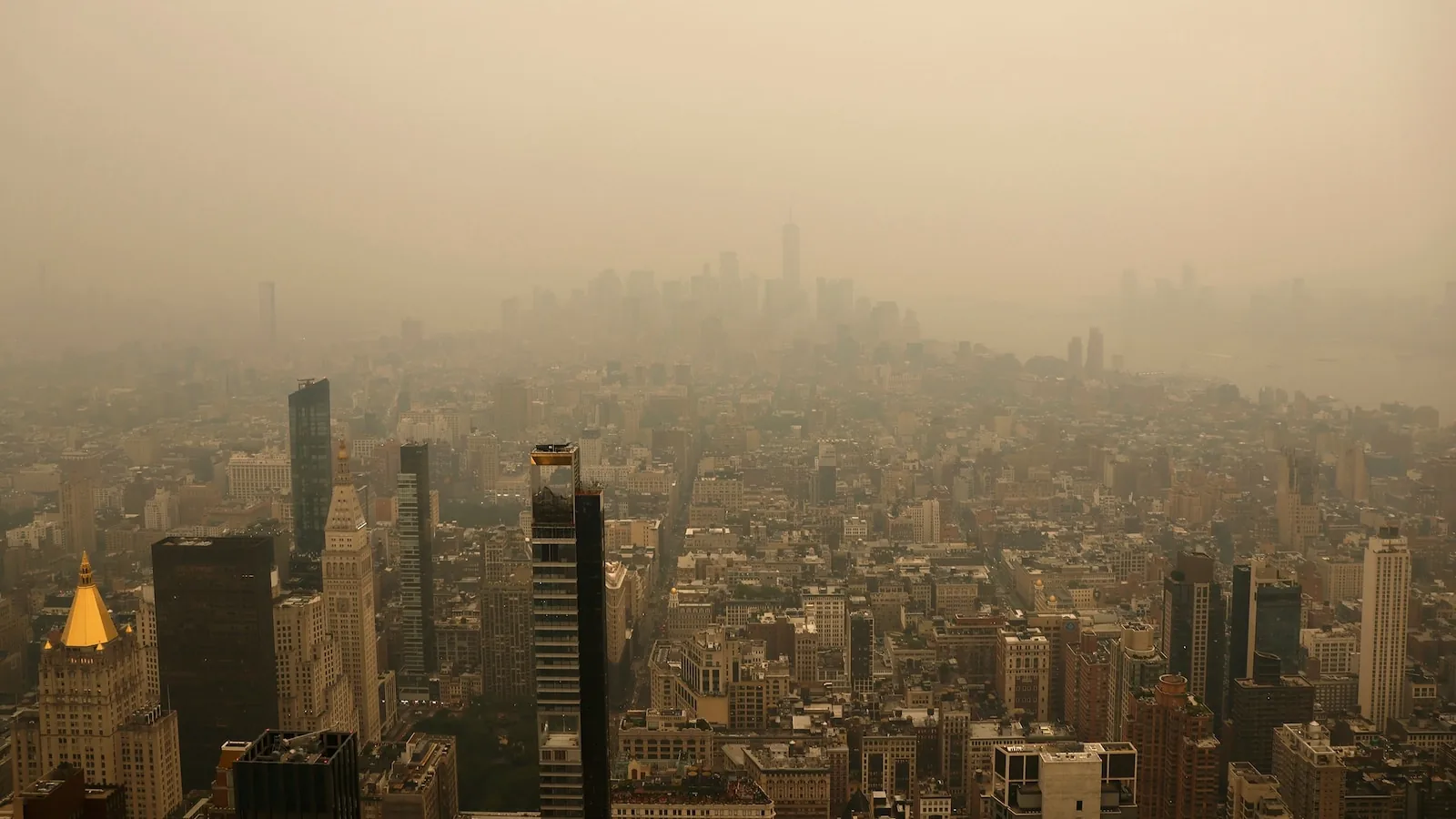
Canadian Wildfire Smoke Blankets New York City and the Northeast as Dangerous Heat Grips Much of the Country and Alerts Spread Across Multiple States
NEW YORK, NY — Smoke from massive wildfires in Canada drifted into the United States on Wednesday, turning skies hazy over New York City and pushing air quality to unhealthy levels across parts of the Northeast and Upper Midwest. The smoky plume arrived as the region was already dealing with dangerous heat, creating a difficult combination for millions of people.
Officials in New York issued an Air Quality Health Advisory for the entire state on Thursday, while air monitors showed unhealthy conditions in New York City, the Eastern Lake Ontario region, Central New York and parts of Western New York. The haze was visible over the city skyline, and conditions were expected to remain poor into Thursday before gradually improving later in the week.
Wildfire smoke spreads from Ontario into major U.S. population centers
More than 830 wildfires were burning in Canada, including some of the largest in west-central Ontario, where thick forest fires were releasing heavy amounts of smoke. Winds carried that smoke south and east into the U.S., affecting air quality across a broad swath of the country.
AirNow data showed especially bad smoke in places such as Duluth, Minnesota, Marquette, Michigan, and northern Wisconsin. Heavy smoke was also moving across New York state and New England, with the plume reaching toward New York City, Boston, Philadelphia and other major urban areas by Wednesday evening. Air quality alerts stretched from Minnesota to New York City.
Officials said the smoke could become serious enough to affect not just people with breathing problems, but the general public as well. That raised concern for outdoor workers, children, older adults and others who are more vulnerable when air becomes unhealthy.
Mayor Zohran Mamdani urges New Yorkers to limit outdoor exposure
New York City Mayor Zohran Mamdani said in a social media statement that the city was seeing unhealthy air because of the Canadian wildfires. He warned that poor air quality affects everyone, but said some groups are more sensitive than others, including people with heart or lung conditions, pregnant New Yorkers, older adults, infants and children.
Mamdani urged residents to avoid unnecessary outdoor activity and to stay inside in air-conditioned spaces if possible. He also said the city was providing free masks to help people cope with the smoke. The advice came as the city’s skyline took on a cloudy orange cast under the haze.
While the conditions are serious, they were not expected to reach the same intensity New York saw in June 2023, when smoke from Canadian fires turned the skies orange. Even so, forecasters said the air in the city could still become unhealthy as the smoke lingers.
Heat wave compounds the smoke threat across the Northeast and Midwest
The smoke is arriving during a coast-to-coast heat spell that is pushing temperatures near or above 100 degrees in several regions. Along the East Coast, from Washington to New York City, temperatures could climb to near 100 on Wednesday, with humidity making it feel even hotter.
Heat indices are expected to reach 104 in New York City, 105 in Washington and as high as 107 in Philadelphia. Minneapolis remains under an extreme heat warning through Thursday, with the heat index there forecast near 100. Forecasters said Wednesday is likely the hottest day of the Northeast heat stretch, before cooler air moves south over the next few days.
The combined stress of heat and smoke can make it harder for people to stay safe outdoors, especially when air quality drops and temperatures stay elevated at the same time.
California also faces extreme heat as temperatures surge in the West
Farther west, an extreme heat warning was issued for the Los Angeles area on Wednesday and is expected to stay in effect until Thursday night. Temperatures in Southern California rose into the high 90s and triple digits, adding another major weather hazard to the national picture.
Los Angeles and Orange counties were expected to reach 96 degrees on Wednesday, with lows around 69. Temperatures were forecast to ease into the low-to-mid 80s by Friday and remain there through the weekend. In California’s San Joaquin Valley, temperatures were also expected to top 100 degrees, with Fresno near 104 and Bakersfield near 105.
The West Coast heat adds to the broader pattern of dangerous weather affecting multiple regions at once, even as smoke and flooding dominate other parts of the map.
Texas flood emergency remains severe as storms bring more rain and a tornado touches down near San Antonio
In Texas, flash flooding was expected to continue in the Hill Country after 6 to 16 inches of rain already fell this week and triggered numerous water rescues. Parts of South-Central Texas were under a rare 4 out of 4 flooding risk level, and an additional 6 to 12 inches of rain was expected in the region.
The forecast targeted communities including Loma Alta, Uvalde and San Antonio, where as much as 20 inches of rain could fall in some local areas. Heavy rain has kept emergency crews busy and left the region facing continued flood threats.
Multiple witnesses also reported a tornado touching down near San Antonio on Wednesday morning. There were no immediate reports of damage, but the storm system added another layer of concern to a week already marked by flooding, severe weather and widespread alerts.